PERSONALIZED HAWAII TOURS
Top Oahu Circle Island Tour Stops You Should Not Miss
May 28, 2026
Best Stops on an Oahu Circle Island Tour

A Circle Island Tour loops the entire perimeter of Oahu in a single day, moving through the south shore, the windward coast, the famous North Shore, and the agricultural center before looping back to Waikiki.
That sounds simple on a map, but the order of stops matters more than most visitors expect.
Go counter-clockwise or hit the North Shore too late, and you spend half the day stuck in traffic rather than standing at a blowhole or watching turtles rest on the sand.
The stops on this route are spread across completely different landscapes and moods: dramatic lava cliffs, lush valley temples, golden surf beaches, and a sleepy surf town famous for shave ice.
This guide walks through each region in sequence so you can picture the full loop, understand what makes each stop worthwhile, and decide how you want to experience it.
Why Take a Circle Island Tour
For first-time visitors, the Circle Island route solves the biggest problem with Oahu: the island looks compact on a map but takes far longer to drive than most people plan for.
Traffic around the Pali Highway, parking at Waimea Bay, and the time between lookouts all add up quickly.
A single day of impromptu driving can leave you having seen two or three spots when the full loop covers ten.
The real value of the Oahu Circle Island Private Experience is what it removes from your plate.
Your guide handles the route timing, knows which parking lots are full by midday, and adjusts the pace when a stop runs long.
You arrive at each location relaxed, with context already in your head, instead of consulting your phone while trying to find a shoulder to park on.

South Shore Lookout Stops
The tour begins east of Waikiki along the Kalaniana'ole Highway, where the coastline turns dramatic before you have even left the city behind.
This first stretch is a series of elevated pull-offs, each one framing a different slice of the southeast shore.
The views come quickly and the stops are short, which is exactly right for early morning when the light is clean and the parking is still manageable.
Diamond Head and the Amelia Earhart Lookout
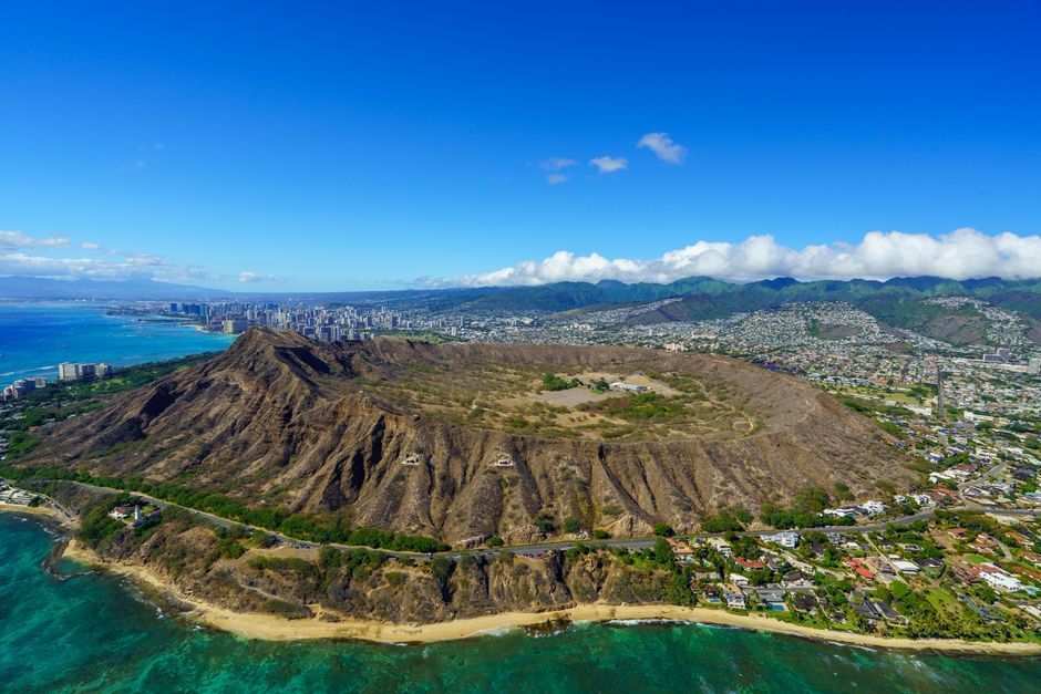
The first major pull-off sits near the base of Diamond Head crater, where a curved shoulder opens up a panoramic view of the southeast coastline and the turquoise water below the Kuilei Cliffs.
This same spot is tied to aviation history: it marks the area near where Amelia Earhart began her solo trans-Pacific flight from Hawaii to California in 1935, the first solo flight of that route by any pilot.
On a clear morning, the combination of the coast stretching ahead and that quiet piece of history makes it one of the most photogenic and underrated stops of the day.
Halona Blowhole and Cove
A few miles further along, the road passes through ancient lava fields that meet the ocean in a jagged, spray-soaked edge.
The Halona Blowhole is a natural lava tube that channels swells upward, shooting a column of saltwater into the air with each wave.
The timing and height change with swell size, so some visits produce a quick puff while others send spray ten feet skyward.
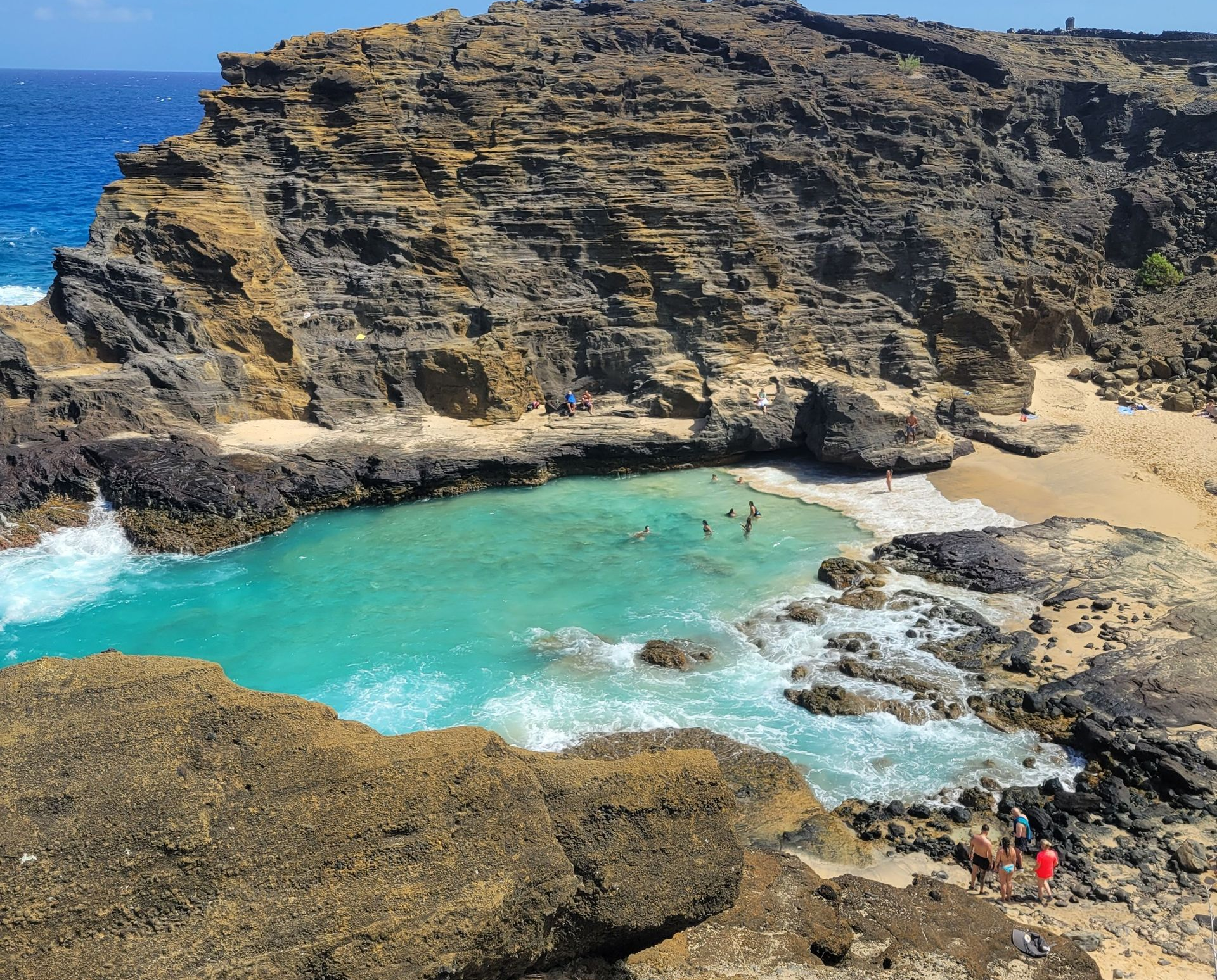
Just below the blowhole overlook sits Halona Cove, a small crescent of sandy beach accessed by a steep path.
Many visitors recognize it immediately as the beach from the famous wave scene in "From Here to Eternity."
The cove is sheltered enough to feel private even when the highway above is busy, and the contrast between the lava-framed walls and the blue water is striking from either angle.

Makapu'u Lookout Views
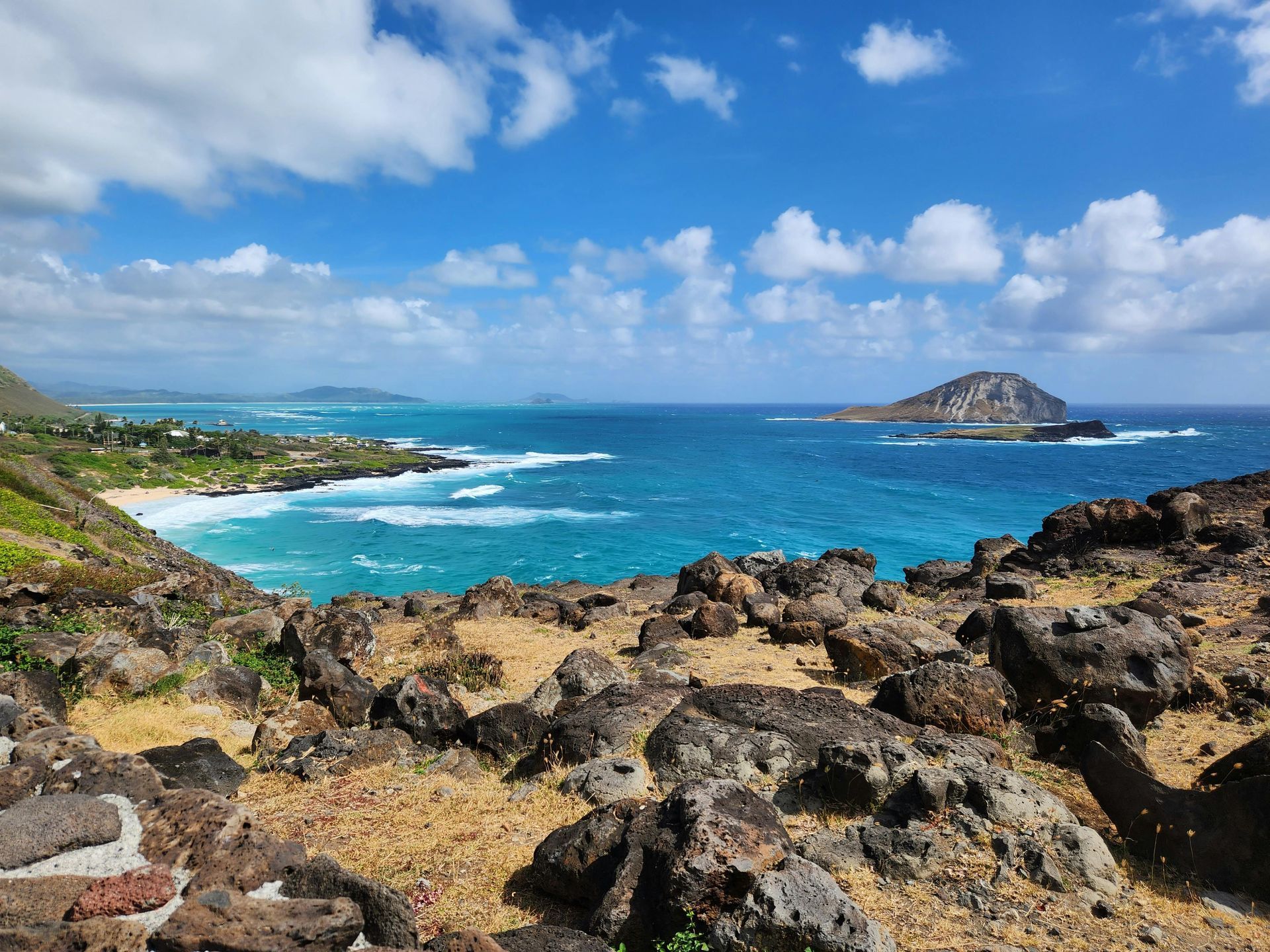
The highway rises sharply past Sea Life Park before arriving at Makapu'u Lookout, where the view opens over the entire southeastern corner of the island.
Rabbit Island (Manana Island) sits just offshore, a small wildlife refuge shaped like a crouching animal.
The historic Makapu'u Lighthouse is visible below on a rocky point, connected by a trail that the lookout overlooks directly.
Between December and May, humpback whales move through the channels visible from this point during their annual migration to Hawaiian waters.
Sightings are not guaranteed, but the elevation and clear sightlines make Makapu'u one of the best whale-watching vantage points on the island without requiring a boat.
Windward Coast Highlights
After Makapu'u, the road descends into the windward side and the landscape shifts completely.
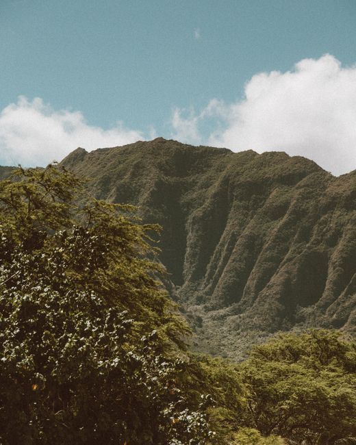
The dry, exposed lava of the south shore gives way to green valleys, towering Ko'olau ridges, and a much quieter feeling.
This is the part of Oahu that most tourists never reach, and the contrast with Waikiki feels immediate and welcome.
Nu'uanu Pali Lookout
The Pali Lookout sits at a notch in the Ko'olau mountain range where trade winds funnel through with enough force to push you sideways.
The view is one of the most dramatic on the island: a sheer drop into the windward valley, with Kaneohe Bay and the Pacific stretching beyond.
Hats and loose items go quickly here, which your guide will mention before you step out.
The Pali carries weight beyond the scenery.
In 1795, during the unification of the Hawaiian Islands, King Kamehameha I drove hundreds of O'ahu warriors over these cliffs during the Battle of Nu'uanu.
Standing at the edge, the history is not incidental; it is the reason the place feels as heavy as it does.
Byodo-In Temple Gardens
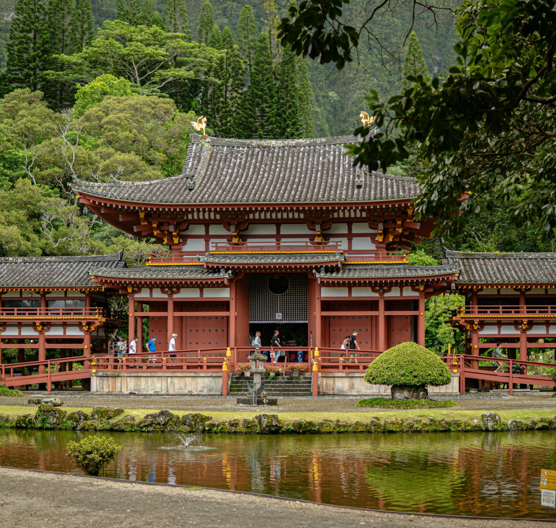
Set against the Ko'olau cliffs in the Valley of the Temples Memorial Park, the Byodo-In Temple is a non-denominational replica of a 900-year-old Buddhist temple in Uji, Japan, built in 1968 to honor Hawaii's Japanese immigrants.
The gardens are quiet and deliberately unhurried.
Koi fill the reflecting pond, peacocks wander the grounds freely, and the massive sacred bell near the entrance is available to ring.
The backdrop of the folded green cliffs behind the vermilion temple is the kind of view that explains why photographers return here repeatedly.
It is one of the few stops on the loop where the sense of stillness is completely genuine, and it provides a natural counterpoint to the wind and spray of the south shore.

Chinaman's Hat and Kualoa
Continuing north along the Windward Coast, Mokoliʻi Island appears offshore, a small pointed islet that has been called Chinaman's Hat for over a century due to its distinctive coolie hat profile from certain angles.
The view is best from the roadside pull-offs near Kualoa Regional Park, where the dramatic valley walls behind the park close in like natural theater.
Kualoa's valley and coastline have served as filming locations for multiple Jurassic Park movies, Kong: Skull Island, and other productions.
The scale of the mountains and the open valley floor explain why filmmakers keep returning.
Even without that context, the combination of water, reef, mountain, and the silhouette of Mokoliʻi Island makes this stretch one of the most photographed moments of the loop.
North Shore Must-See Stops
The North Shore sits at the top of the island and carries a specific kind of gravity for anyone who follows surfing or has ever wanted to see big waves in person.
In winter, swells here regularly reach twenty to thirty feet, drawing the world's best surfers to a seven-mile stretch of coastline.
In summer, the same water flattens into calm, swimmable turquoise.
The stops are short, but the energy of the place stays with you.
Waimea Bay and Pipeline
Waimea Bay is one of the most recognized surf spots on earth, a wide crescent where the road drops right to the waterline and the beach parking fills by mid-morning during winter.
During large swells, waves break directly in front of the parking area and spray mist across the road.
In summer, the bay is calm enough for swimming and cliff jumping from the rock on the north end.
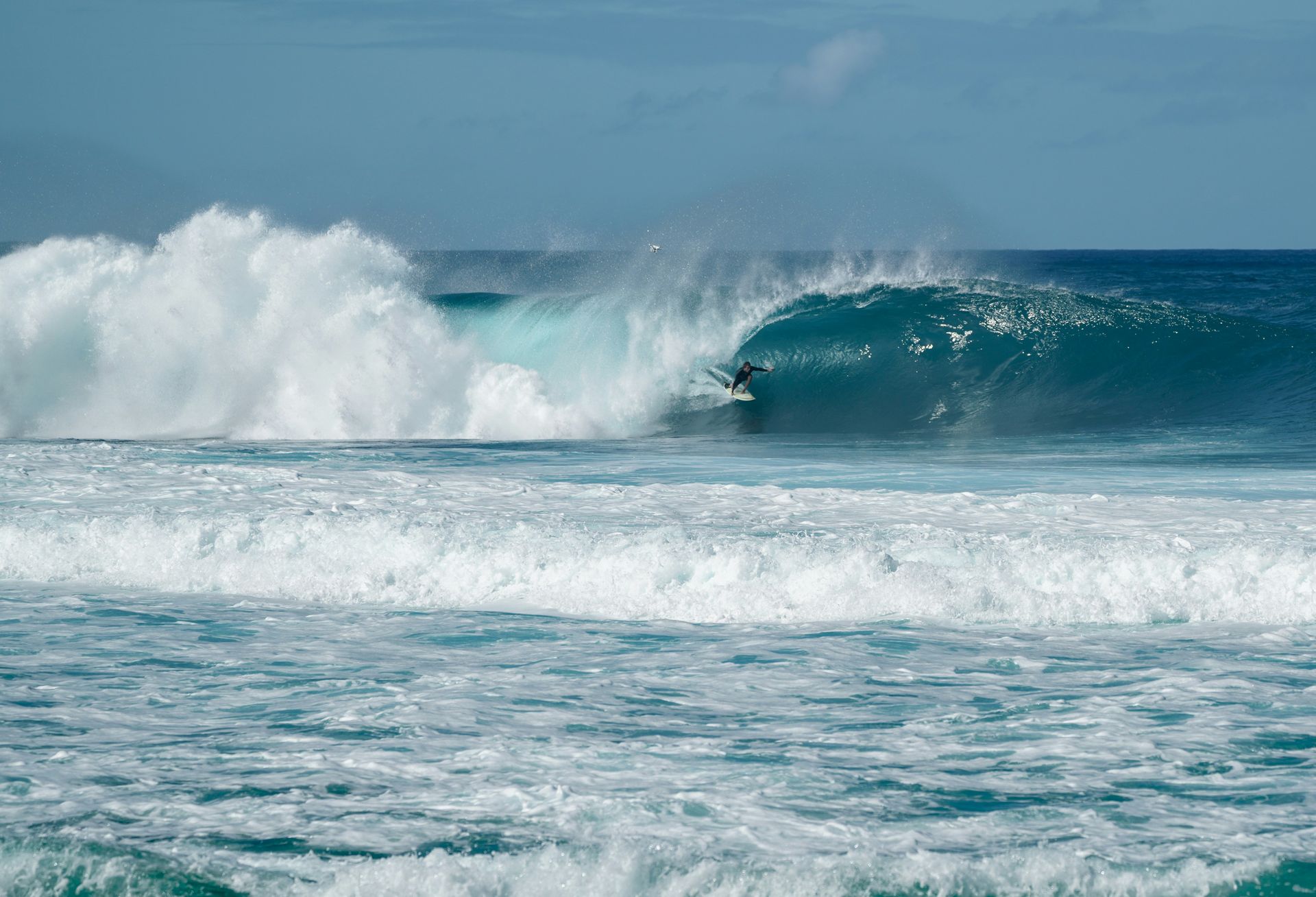
A short drive east, the Banzai Pipeline breaks over a shallow reef just offshore in front of Ehukai Beach Park.
The wave here is fast, hollow, and unforgiving, producing the barrel shape that has defined surf photography for decades.
From the beach, the Pipeline is close enough to watch clearly without any special equipment, and winter days draw crowds of photographers along the shoreline.
Sunset Beach and Turtles
Sunset Beach is the widest stretch of sand on the North Shore and feels noticeably different from the east-facing beaches earlier in the day.
In winter, the beach narrows dramatically as larger swells push up the shore; in summer, it expands back into a broad, walkable expanse.
The afternoon light on this beach is particularly good for photographs.
A few minutes south, Laniakea Beach and the nearby Puaʻena Point area are known as regular resting spots for Hawaiian green sea turtles (honu).
Turtles haul themselves onto the beach to rest, and state law requires visitors to maintain a minimum distance.
Sightings are common but not guaranteed; your guide will know current conditions.
The turtles carry deep significance in Hawaiian culture as personal guardian spirits, or aumakua, for certain families.
Historic Haleiwa Town
Haleiwa marks the western end of the North Shore's surf corridor and a welcome change of pace.
The main street along Kamehameha Highway is lined with surf shops, local art galleries, small restaurants, and food trucks that have been operating in the same spots for decades.
This is the natural midpoint for a lunch break or a shave ice stop; the town's two most famous shave ice shops are both worth the short walk, and the North Shore private tour typically includes time to explore Haleiwa at your own pace.
The town retains a genuinely local feel despite its fame.
The storefronts stay low, the streets stay narrow, and the pace matches the town's surfing identity rather than the resort speed of Waikiki.
A slow half-hour here resets the day before the return leg through the island's center.
Central Oahu and Final Stop
From Haleiwa, the route cuts south through the broad central plateau of Oahu, where the land flattens between the Ko'olau and Wai'anae mountain ranges and pineapple fields stretch in long rows.
The Dole Plantation sits near Wahiawa and serves as a natural final stop before heading back to Waikiki.
It is not a deep experience, but a Dole Whip (the frozen pineapple soft-serve that has become its own institution) and a brief walk past the pineapple plants offers a satisfying close to a day that began at sea cliffs at sunrise.
Timing the return matters. The H-2 and H-1 freeways leading back to Honolulu and Waikiki carry heavy traffic through the late afternoon commute window.
Leaving Dole by 3:30 or 4:00 p.m. avoids the worst of it.
For a detailed breakdown of how to sequence the whole day, the Oahu Circle Island itinerary guide covers clockwise routing and timing windows in depth.
Tips for the Best Loop Day
Starting before 8:00 a.m. makes a measurable difference.
Lookout parking at Halona and Makapu'u fills quickly on weekends, and the North Shore beach lots can be full by 10:00 a.m. in peak season.
A clockwise route (south shore first, then windward, then North Shore) keeps you moving with traffic rather than against it and ensures the best light at the south shore lookouts.
Pack reef-safe sunscreen, a refillable water bottle, and comfortable walking shoes.
A light layer helps at the Pali Lookout regardless of the season.
The loop covers a lot of ground, so the travelers who enjoy it most tend to be selective: committing fully to the high-value stops rather than trying to add every possible detour.
A private guide makes that editing process effortless because they have already done it for thousands of visitors and can adjust in real time when a stop runs longer than planned.
Ready to See Oahu in One Day?
A Circle Island Tour is the most efficient way to understand what Oahu actually is: not just Waikiki and Pearl Harbor, but a complete island with rainforest valleys, a surf-famous coastline, historic temples, and a town where the pace drops to something genuinely unhurried.
When you cover it in the right order with someone who knows every pull-off and parking window, the day feels calm rather than rushed.
If you are ready to build your own version of this loop, reach out to the team at Oahu Private Tours.
A private guide handles every logistical detail so you can spend the day looking out the window, not at Google Maps.